UK Campaign Planning Tool
Stop guessing leaflet drop and mailing volumes
Draw a target area, get an accurate property count, and plan your campaign before you quote, print or deliver.
Geolist Wholesale helps leaflet distribution companies, mailing houses, printers and campaign teams check real UK property counts before committing to campaign costs.
Simple pricing
Geolist Wholesale
Start with a 7-day free trial.
- Unlimited area drawing and property counts
- UK campaign planning and area targeting
- Licensed Ordnance Survey data
Cancel during the 7-day trial and you will not be charged.
When you need address data, you can purchase it separately at wholesale rates.
Start free trialCheck the campaign before you commit
Draw the area
Use postcode searches, radius tools or custom polygons to build your campaign area on the map.
Check the count
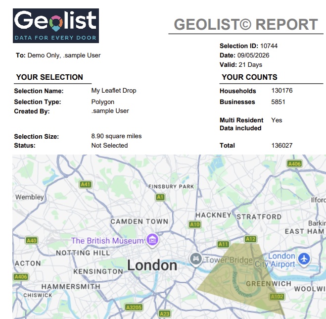
Get an instant property count before quoting, printing or booking delivery. Reduce planning risk from the start.
Plan the job
Use accurate counts to plan print quantities, delivery workloads, mailing volumes and client quotes.
Buy data when ready
Plan the campaign first. Purchase accurate UK address data separately only when you are ready to mail.
See how campaign areas and counts are built
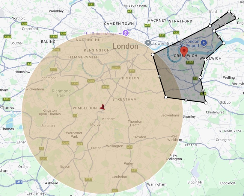
Draw target areas
Use postcode searches, radius tools and custom polygons to build accurate campaign zones.
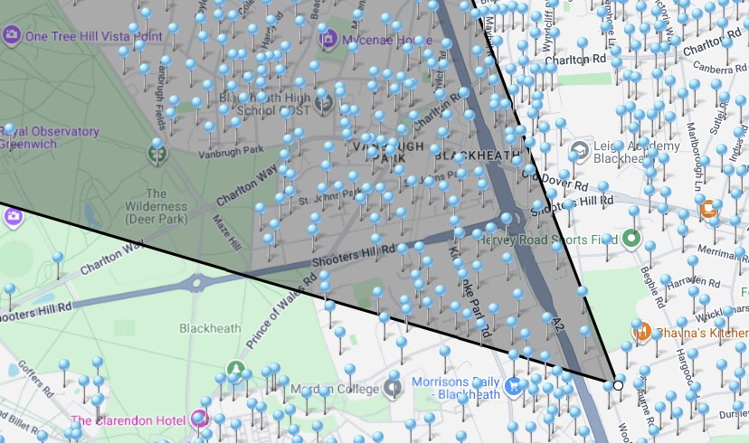
View instant property counts
See property counts inside your selected area before printing or delivery starts.
Plan campaigns with confidence
Build reliable leaflet distribution and direct mail campaigns using accurate UK property data.
Built for trade campaign planning
Geolist Wholesale is built for businesses that need to check property counts, plan delivery areas and prepare campaign volumes before committing to print, delivery or mailing costs.
Leaflet distribution companies
Plan delivery areas, check property counts and quote campaigns with greater confidence.
Mailing houses
Estimate volumes, prepare campaigns and access accurate address data when required.
Printers
Help customers plan print quantities before artwork, production or delivery begins.
Political campaign teams
Plan leaflet drops and local campaign areas using accurate UK property counts.
Direct mail companies
Build targeted mailing areas and purchase address data when campaigns are ready.
Businesses buying address data
Check target areas first, then buy the data needed for addressed campaigns.
Wrong counts cost money
Poor property counts affect print quantities, delivery planning, quotes and client relationships. The problems are operational and they are expensive.
- Over-printing wastes budget
- Under-printing misses homes
- Delivery gaps create client complaints
- Weak quotes based on guesswork lose business
- Unreliable counts damage client trust
- Guesswork increases overall campaign risk
How it works
Draw or search the area
Use postcode searches, radius tools or custom polygons to define your campaign area on the map.
Check the property count
Instantly see how many properties are inside the selected area before any cost is committed.
Plan print, delivery or mailing volumes
Use accurate counts to prepare quotes, plan delivery workloads and estimate mailing quantities.
Buy address data when required
Purchase accurate UK address data separately only when the campaign is ready to proceed.
Try it before you commit
Test the counts, explore the tools and see whether Geolist Wholesale fits your workflow before the monthly subscription begins.
- 7-day free trial
- £60 inc VAT per month after the trial
- Cancel during the trial and you will not be charged
- Address data purchased separately when required
- Built for UK leaflet and mailing campaigns
- Licensed Ordnance Survey data
- Royal Mail PAF data
- Address data available at wholesale rates
- 7-day free trial
Check the count before you quote, print or deliver
Use Geolist Wholesale to plan leaflet drops, direct mail campaigns and UK address targeting using accurate property counts.
Start your free trialThe data behind the count
Geolist Wholesale uses licensed data from Ordnance Survey and Royal Mail PAF, then cleans and enhances it for UK leaflet distribution, direct mail and campaign planning. This is not a generic mapping tool. It is built from real campaign experience.
When you need address data, you can purchase it separately at wholesale rates. You only buy what you need, when you are ready.
Licensed Ordnance Survey data
Start your free trial
Create your account below and continue to secure payment setup. Your 7-day free trial begins immediately.
- 7-day free trial — no charge until trial ends
- £60 per month after the trial
- Cancel during trial and you will not be charged
- Address data purchased separately at wholesale rates
Already have an account? Sign in